
Aerial photos
$99
The essential angles
For one nearby, simple property photographed in daylight.
- 10–12 edited daytime aerial photos
- One nearby, simple property
- High-resolution and web/MLS-ready JPEG files
- Listing and social-media usage included
FAA Part 107-certified drone operator
Drone photography and video for listings, land, and vacation rentals. Get 15–20 edited aerial photos and a short video clip for $150, or start with photos for $99.
Tempe, AZ · Phoenix metro · Minnesota summers
Selected work
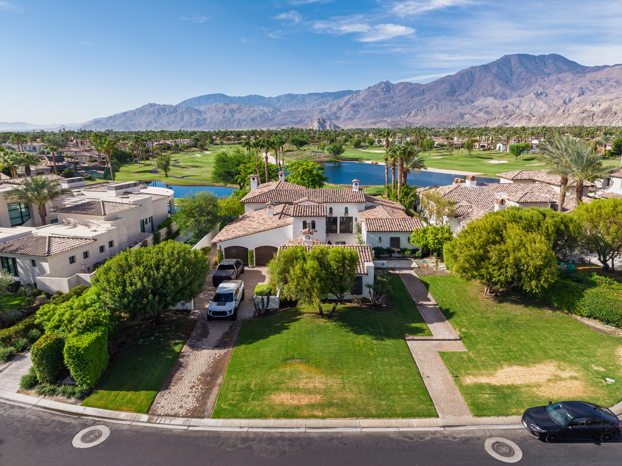
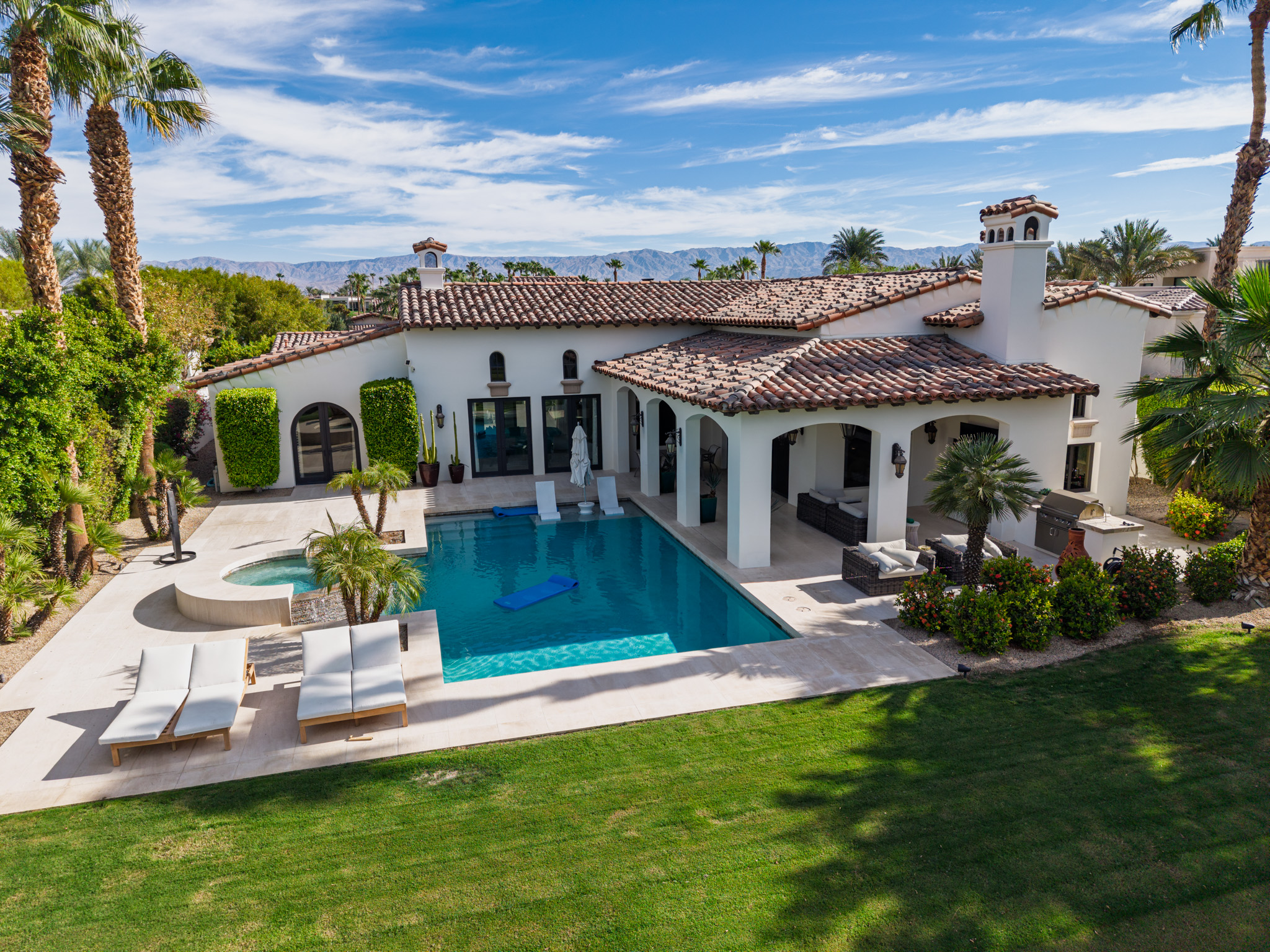
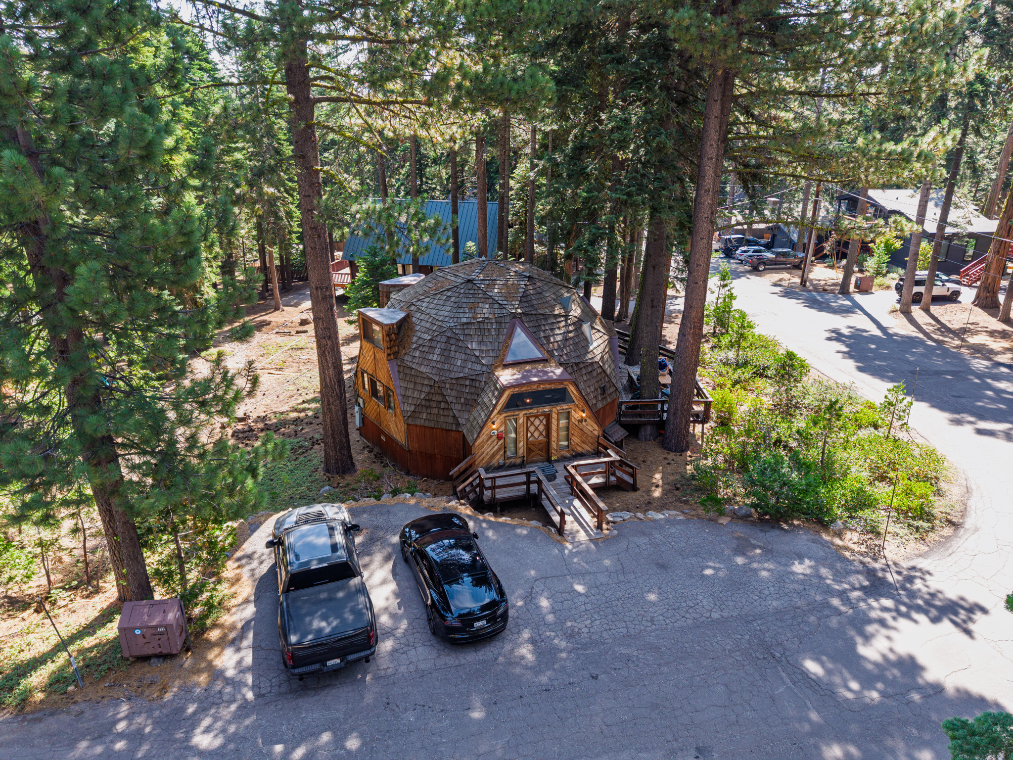
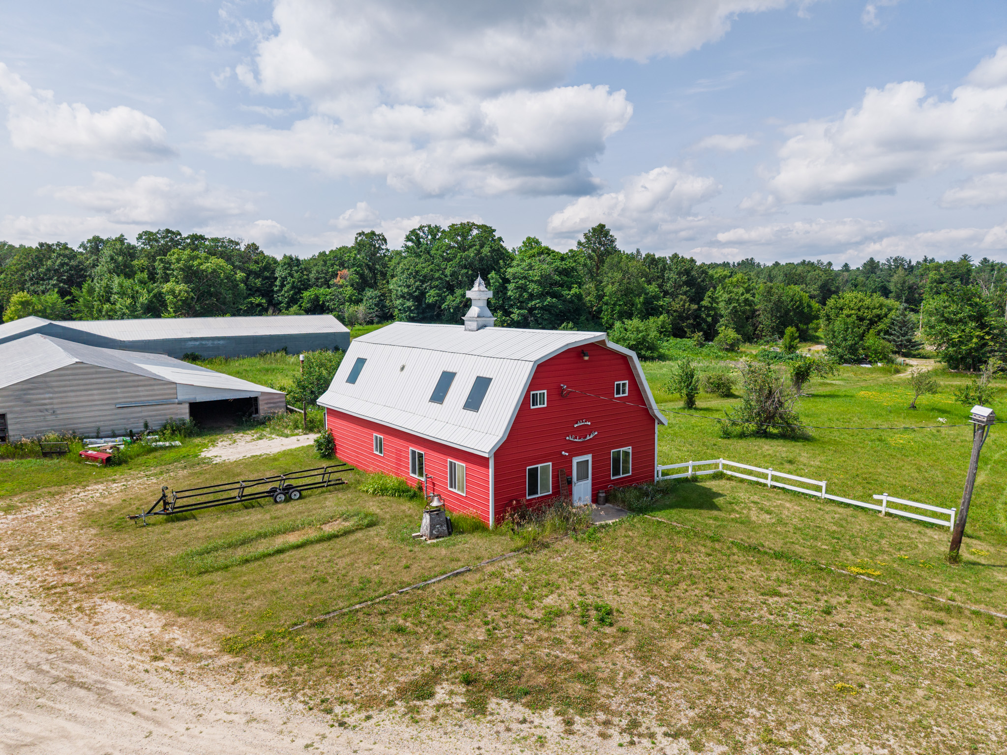
Aerial photographs give buyers the context ground-level images miss: access, scale, outdoor space, surrounding trees, and how everything fits together.
Straightforward pricing
Start with the photos. Add a short clip for easy posting, or choose a finished film with music and titles. The $150 package is my recommendation for photos and video together.
Aerial photos
$99
For one nearby, simple property photographed in daylight.
Photos + video clip
$150
More property views and a short video clip in one straightforward package.
Photos + edited film
$225
A photo set and a complete video that brings several property views together.
Exterior aerial services only. The $99 option covers one nearby, simple property in daylight. Substantial travel, large acreage, multiple buildings, and complex commercial sites are quoted separately. Exterior 3D property models are also quoted separately for eligible properties. Weather and airspace are checked before every shoot; delivery timing is agreed before booking.
Aerial films
See the difference between a short aerial clip and a finished edit. These are real properties I’ve filmed, from desert homes to forest cabins.
Desert estates, forest cabins, and the setting around them.
Music: “First Snow” by Scott Buckley, licensed under CC BY 4.0.
Short aerial clip examples · photos + clip package $150
Interactive examples
Explore examples below. Exterior 3D models are quoted separately for eligible properties.
Recent project
A South Lake Tahoe property photographed from the air, edited, and delivered digitally for the listing agent.
View the finished workSouth Lake Tahoe propertyClient message after delivery
“That’s awesome. Thank you.”
How it works
Start with the address. I’ll review the property, confirm what is possible, and plan coverage around what the listing needs to show.
Tell me which property features buyers or guests should understand.
I review the location and confirm your package, total price, shoot time, and delivery timing.
I photograph the property and deliver your edited photos and selected video package digitally, ready for your listing and social posts.
Common questions
No. I currently focus on exterior aerial photography, edited aerial videos, and exterior 3D property models.
10–12 edited daytime aerial photos of one nearby, simple property.
Send the property address and the features you want buyers or guests to understand. I’ll review the location and confirm the flight requirements before scheduling.
Yes. I can handle the airspace authorization when it is needed and confirm what is possible for the property.
We agree on delivery timing before booking, based on the photo and video coverage you choose.
I check the weather and airspace before every shoot. If conditions are not safe for useful aerial coverage, we’ll coordinate a new time.
The $150 package includes 15–20 edited aerial photos plus one 15–30 second aerial clip, trimmed and color-corrected. One agreed video format: landscape or vertical. The $225 package includes 15–20 edited aerial photos plus one finished 30–60 second video with several shots, licensed music, simple titles, and one minor revision. One agreed video format: landscape or vertical.
Yes. Exterior 3D property models are quoted separately for eligible properties. Send the address so I can check the site and plan the coverage.
I’m generally available except Tuesdays and Thursdays before 5 p.m. Arizona time. Send your preferred date; the time is confirmed after reviewing the property, access, weather, and airspace.
Plan your shoot
Send the address, choose a package, and share your preferred date. I’ll reply with availability and confirm the total before you book.
Layton DoslakTempe-based · FAA Part 107 certifiedDirect communication from planning through delivery